This site and its contents are copyright © 2026 Advanced Construction Techniques
Toll Free: 877 373 7248
Toll Free: 877 373 7248


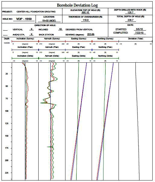
BOREHOLE SURVEY
There are several tools that can be used to measure the deviation of the borehole path. ACT uses the Robertson Geologger®, Reflex Maxibor® or Reflex Gyro® to map and collect coordinates. The instrument and method used to survey a hole is dictated, to an extent, by the type of hole and the lithology through which the hole has been drilled, as well as the inclination of the hole.
Data is exported to generate a graphical representation of the borehole path along the x, y, and z coordinate planes. The deviation is then plotted and displayed to show the difference between the design and survey.
The data is displayed as normal to the bearing, parallel to the bearing, and in plan view.
- Surveying to depths exceeding 1,000 feet (300 m)
- Vertical, inclined and horizontal holes
- Target location versus actual location

Always Looking Ahead